Quick answer
Franz Josef Glacier is a 12-kilometer temperate maritime glacier on New Zealand's South Island that flows from the Southern Alps' névé at 2,900 meters down to a terminal face at approximately 240 meters above sea level. Known in Māori as Kā Roimata o Hine Hukatere, it is one of only three glaciers worldwide that descend from alpine heights into rainforest zones, creating an environment where ice meets dense native bush within walking distance.
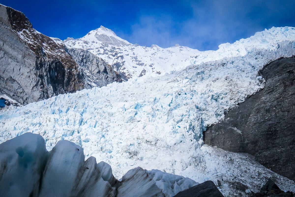
The glacier advances at rates up to ten times faster than typical alpine glaciers, a velocity driven by the West Coast's extreme precipitation—more than seven meters of rain and snow fall annually in the accumulation zone. This pace makes the ice river one of the most dynamic temperate glaciers on Earth, though recent decades have seen net retreat as warming trends outpace snow accumulation. What is Franz Josef Glacier in geological terms? It is a valley glacier carved through schist and greywacke bedrock over millennia, fed by five tributary névés high in the Waiho Valley. The ice descends through a series of icefalls where the gradient steepens, creating the fractured blue seracs visible from valley viewpoints. At lower elevations, rock flour suspended in glacial meltwater gives the Waiho River its distinctive milky grey color, a visible record of ongoing erosion beneath the ice. The terminal face sits within Westland Tai Poutini National Park, roughly five kilometers from the township. Department of Conservation maintains valley walking tracks to viewpoints at Sentinel Rock and the glacier's former terminal positions, marked by moraines from the 1750 advance and subsequent fluctuations. These moraines create natural boundaries through regenerating rainforest, illustrating the glacier's historical reach. Access to the ice itself requires guided heli-hiking due to unstable conditions and crevasse hazards. Independent walkers reach viewing platforms but do not approach the terminal face—rockfall and ice collapse make unsupervised access dangerous. The glacier's accessibility lies in its proximity to sea level and established infrastructure, not in ease of contact with the ice. Helicopter operators based at 69 Cron Street offer flights that land on the névé, the only current legal method for visitors to stand on the glacier surface. The West Coast glacier remains a study in contrasts: ancient ice meeting subtropical rainforest, rapid movement amid long-term retreat, and remote alpine origins terminating near populated lowlands.
“Franz Josef advances at rates up to ten times faster than typical alpine glaciers, driven by the West Coast's seven meters of annual precipitation.”
The Best Time to Visit and What Is Franz Josef Glacier Access Like
The best arrival window is 08:30–10:00, as this period typically offers clearer weather and lower visitor numbers. Planning your visit early helps navigate the daily fluctuations in mountain visibility and crowd density.
Early Morning
Low densityClearer skies; typically 5°C to 15°C
Arriving before 10:00 minimizes congestion and provides the highest chance of stable weather.
Summer (Dec–Feb)
High volumeWarmest weather; averages 12°C to 20°C
Expect the largest crowds and frequent high-season activity throughout the region.
Shoulder Months (Mar–May, Sep–Nov)
Moderate volumeVariable conditions; averages 8°C to 16°C
These months offer a balance between manageable visitor numbers and moderate temperatures.
Winter (Jun–Aug)
Lowest volumeColdest weather; averages 2°C to 10°C
Shorter days and colder temperatures are common, though visitor numbers are at their lowest.
Verdict: The best time for a visit is between 08:30–10:00 during the shoulder months of April or October to balance crowd levels and weather conditions.
Daily Opening Hours: What Is Franz Josef Glacier Access
The Franz Josef Glacier area remains open daily to visitors throughout the week. Access times are consistent across all seven days to assist with your trip planning.
| Monday | 08:30–17:00 | |
|---|---|---|
| Tuesday | 08:30–17:00 | |
| Wednesday | 08:30–17:00 | |
| Thursday | 08:30–17:00 | |
| Friday | 08:30–17:00 | |
| Saturday | 08:30–17:00 | |
| Sunday | 08:30–17:00 |
Entrance Fees and What Is Franz Josef Glacier Pricing
Access to the Westland Tai Poutini National Park and the glacier viewing tracks is managed by the Department of Conservation. There are no entrance fees required to enter the park or utilize these walking paths.
A typical adult pays 0 NZD for general park and track access, as there are no admission fees for these public areas.
Directions: How to Reach What Is Franz Josef Glacier
Franz Josef Glacier is located on the West Coast of the South Island, New Zealand. The primary access point for visitor information and departure logistics is at 69 Cron Street, Franz Josef Glacier 7856.
State Highway 6 to Franz Josef Glacier township
InterCity bus service to Franz Josef Glacier stop
Walk from Franz Josef Glacier township to 69 Cron Street
Named Sub-Sights and What Is Franz Josef Glacier Composition
Franz Josef Glacier (Kā Roimata o Hine Hukatere) is a 12-kilometre-long temperate maritime glacier descending from the Southern Alps. It is characterized by its rapid movement and distinct ice formations located within Westland Tai Poutini National Park.
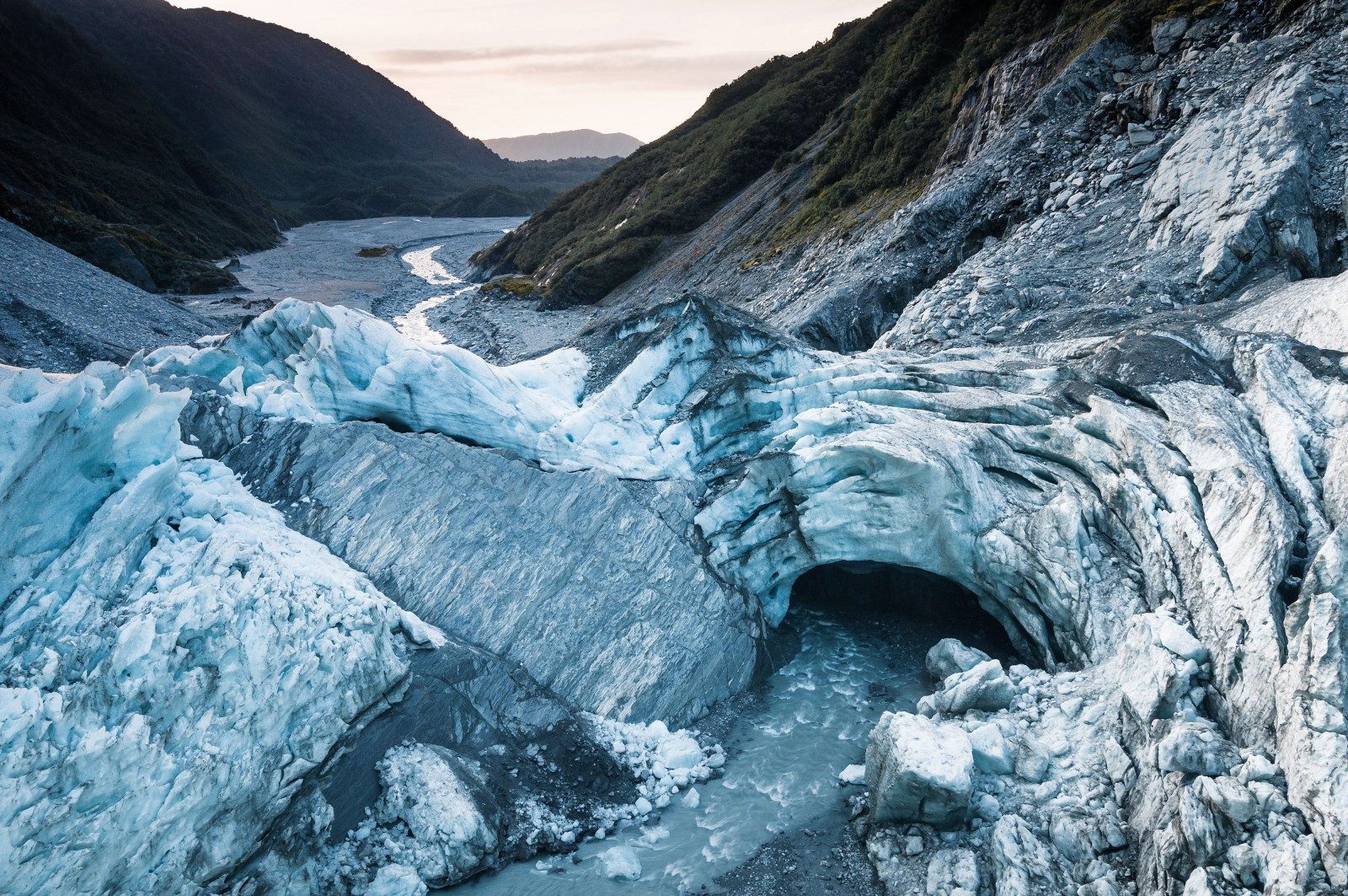
Cairn Glacier Terminal Face
The lowest point of the glacier where ice meets the Waiho River valley floor. This area features dynamic sedimentary deposits and river-carved rock walls.
Visit during the early arrival window for clearer views.
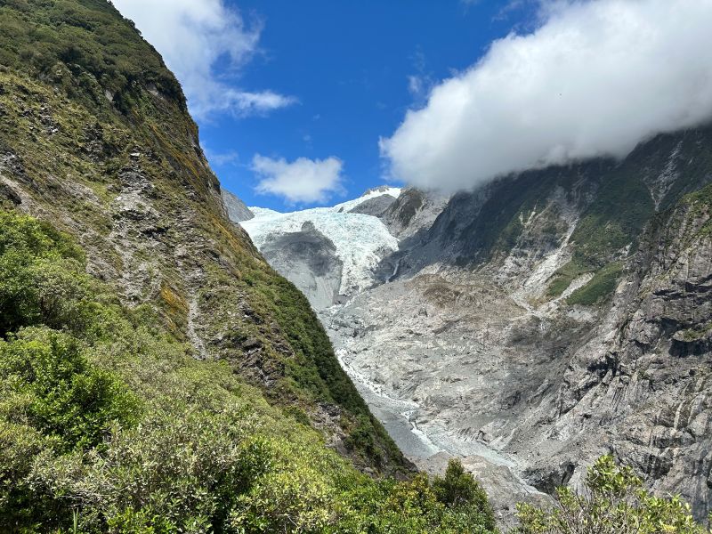
Roberts Point Track
A hiking path that provides an elevated vantage point overlooking the glacier valley. It offers perspectives of the ice flow and surrounding mountain ranges.
Bring binoculars to observe the upper icefall sections.
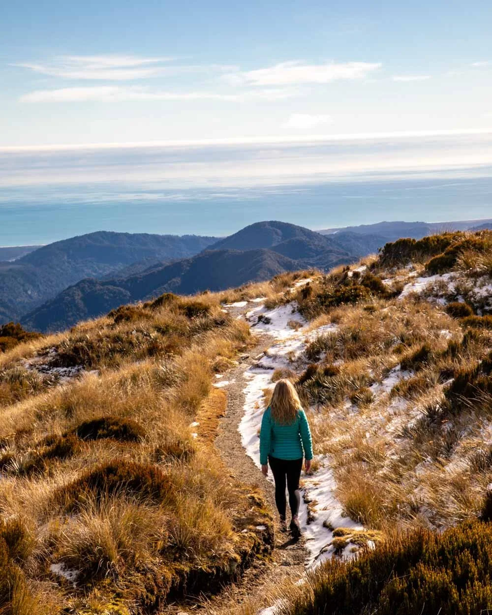
Alex Knob Track
A challenging climb that leads above the forest line to reveal panoramic views of the glacier and the Tasman Sea. It provides a sense of the scale of the glacier’s descent.
Start early to navigate the steep terrain safely.
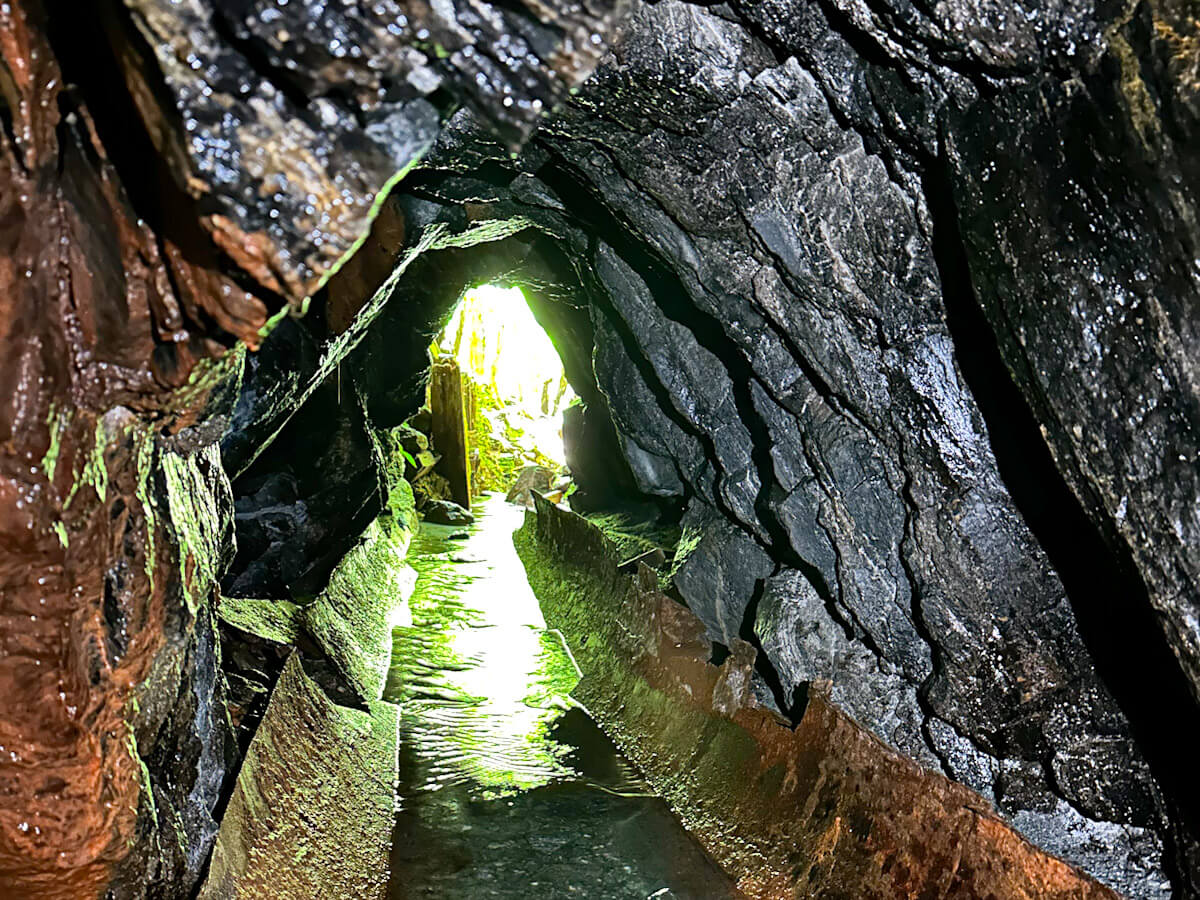
Tatare Tunnels Walk
A historic water tunnel system carved into the rock that leads to a waterfall. While not a direct glacier view, it displays the geological composition of the region.
Bring a torch to explore the dark tunnel interior.
Geological History and What Is Franz Josef Glacier's Legacy
Franz Josef Glacier was named in 1865 by German explorer Julius von Haast, who honored Emperor Franz Joseph I of Austria during his geological survey of New Zealand's South Island. The glacier had advanced significantly during the Little Ice Age, reaching its maximum extent around 1750 when its terminus descended to approximately 300 meters above sea level. Māori oral traditions recorded the glacier as Kā Roimata o Hine Hukatere, tears of the avalanche girl, linking its ice to a legend of loss and transformation. By the early twentieth century, retreat had begun. Between 1865 and 1940, the glacier receded nearly three kilometers, exposing broad valleys and moraines that now form the walking tracks visitors use today. A brief advance occurred between 1982 and 2008, when cooler conditions and increased snowfall pushed the terminus forward by approximately 1.5 kilometers, temporarily reversing decades of loss. Glaciologists documented this anomaly as one of the few advancing glaciers globally during that period. Since 2008, retreat has accelerated. The glacier now loses an average of 150 meters per year, driven by rising temperatures and reduced precipitation. What is Franz Josef Glacier today is a remnant occupying the upper valley, its ice no longer accessible on foot. The terminal face sits roughly 7 kilometers from the village, visible from valley tracks but separated by unstable rock and meltwater channels. Visitors walking the Sentinel Rock track encounter moraines deposited during the 1750 advance, lateral walls marking past ice levels, and informational markers documenting the terminus position in 1865, 1950, and 2008. The glacier's retreat remains an ongoing process.
Glacier reaches its maximum Little Ice Age extent, descending to valley floor
Julius von Haast names the glacier after Austrian Emperor Franz Joseph I
Glacier retreats nearly three kilometers, exposing broad valleys and depositing moraines
Brief advance of 1.5 kilometers recorded, one of few globally advancing glaciers during this period
Sustained retreat resumes, averaging 150 meters of ice loss per year
Terminal face now sits approximately 7 kilometers from Franz Josef village, no longer accessible on foot
Preparation Checklist for What Is Franz Josef Glacier
Alpine conditions demand specific gear and early planning for safe glacier viewing.
-
Check weather forecast 24 hours ahead — Conditions change rapidly in the mountains and poor visibility can close viewing tracks.
-
Wear waterproof jacket and layered clothing — Temperatures drop quickly and rain is common year-round in this alpine zone.
-
Pack sturdy hiking boots with ankle support — Glacier valley tracks are uneven with loose rock and can be slippery when wet.
-
Bring water and high-energy snacks — No facilities exist on the walking tracks leading to glacier viewpoints.
-
Confirm track status on DOC website — Rockfall, ice movement, and weather events can close access without notice.
-
Arrive during 08:30–10:00 window — Clearer weather and fewer visitors make navigation and photography easier.
Check availability
Frequently asked questions about what is franz josef glacier
Everything you need to know about what is franz josef glacier